HS Rare Books company logo
HS Rare Books
Skip to main content
  • Menu
  • Artworks
  • Notable Sales
  • Exhibitions
  • Selling your books
  • Contact
Menu
Artworks

Americana

  • All
  • Americana
  • Early Printing & Illustration
  • History of Ideas & Science
  • Literature
  • Religion & Spirituality
  • Travel & Exploration
Lewis, Meriwether, and William Clark, History of the expedition under the command of Captains Lewis and Clark to the sources of the Missouri, thence across the Rocky Mountains and down the River Columbia to the Pacific Ocean, 1814. Philadelphia. Bradford and Inskeep; and Abm. H. Inskeep, New York.

Lewis, Meriwether, and William Clark

History of the expedition under the command of Captains Lewis and Clark to the sources of the Missouri, thence across the Rocky Mountains and down the River Columbia to the Pacific Ocean, 1814. Philadelphia. Bradford and Inskeep; and Abm. H. Inskeep, New York.
The most important work in American western exploration, with the original folding map

First official edition of the account of the famous Lewis and Clarke expedition (1804-6), complete with the very rare folding map, which "is gone from many if not most of the copies now extant" (Grolier). The importance of the work can hardly be overestimated. It is lauded as the most influential work concerning the exploration of the American West ever printed. The map, which was the first accurate map of the newly acquired Louisiana and filled in many of the areas that were left blank on earlier maps, is a cartographic landmark.
P.O.R.
Enquire
%3Cdiv%20class%3D%22artist%22%3ELewis%2C%20Meriwether%2C%20and%20William%20Clark%3C/div%3E%3Cdiv%20class%3D%22title_and_year%22%3E%3Cspan%20class%3D%22title_and_year_title%22%3EHistory%20of%20the%20expedition%20under%20the%20command%20of%20Captains%20Lewis%20and%20Clark%20to%20the%20sources%20of%20the%20Missouri%2C%20thence%20across%20the%20Rocky%20Mountains%20and%20down%20the%20River%20Columbia%20to%20the%20Pacific%20Ocean%3C/span%3E%2C%20%3Cspan%20class%3D%22title_and_year_year%22%3E1814.%20Philadelphia.%20Bradford%20and%20Inskeep%3B%20and%20Abm.%20H.%20Inskeep%2C%20New%20York.%3C/span%3E%3C/div%3E%3Cdiv%20class%3D%22medium%22%3EThe%20most%20important%20work%20in%20American%20western%20exploration%2C%20with%20the%20original%20folding%20map%3Cbr/%3E%0A%3Cbr/%3E%0AFirst%20official%20edition%20of%20the%20account%20of%20the%20famous%20Lewis%20and%20Clarke%20expedition%20%281804-6%29%2C%20complete%20with%20the%20very%20rare%20folding%20map%2C%20which%20%22is%20gone%20from%20many%20if%20not%20most%20of%20the%20copies%20now%20extant%22%20%28Grolier%29.%20The%20importance%20of%20the%20work%20can%20hardly%20be%20overestimated.%20It%20is%20lauded%20as%20the%20most%20influential%20work%20concerning%20the%20exploration%20of%20the%20American%20West%20ever%20printed.%20The%20map%2C%20which%20was%20the%20first%20accurate%20map%20of%20the%20newly%20acquired%20Louisiana%20and%20filled%20in%20many%20of%20the%20areas%20that%20were%20left%20blank%20on%20earlier%20maps%2C%20is%20a%20cartographic%20landmark.%3C/div%3E

Further images

  • (View a larger image of thumbnail 1 ) Thumbnail of additional image
  • (View a larger image of thumbnail 2 ) Thumbnail of additional image
  • (View a larger image of thumbnail 3 ) Thumbnail of additional image

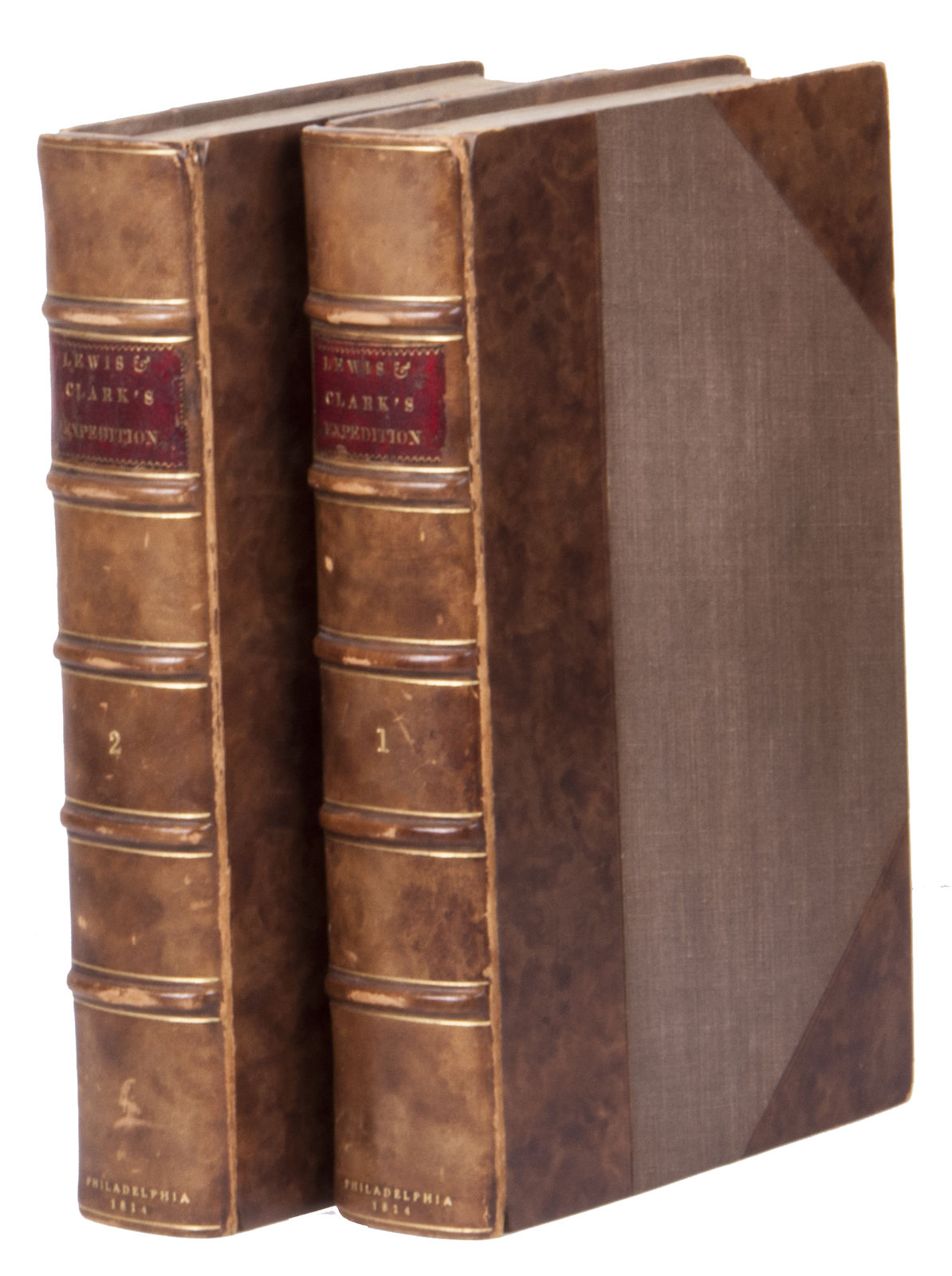
2 volumes. 8vo. XXVIII, 470, [2 blank]; IX, [1 blank], 522 pp. With an engraved folding map, and 5 full-page engraved plates. Modern half calf over cloth-covered boards, faux raised bands to spine, tooled and lettered in gilt, red lettering pieces, edges and corners of the boards are somewhat scuffed, joints slightly weakened. Foxed throughout as usual, folding map has been reinforced with Japanese paper on the back, which has also restored a diagonal tear, a small triangular loss at the top of the map has been restored with facsimile, volume one first quire restored at gutter, small loss at the head of the title-page of the second volume restored, as well as small tears in the margin of a few other leaves throughout.


The objective of the expedition undertaken by Meriwether Lewis (1774-1809) and William Clarke (1770-1838) was to explore the Rocky Mountains, find a way to the Pacific, discover the source of the Missouri River, and establish trading ties with the Natives. They were prompted by Thomas Jefferson, who had realised the importance of exploring the area. Lewis and Clark were the first to travel overland to the Pacific Ocean and back. They brought back a wealth of new information about the geography, natural history, and the many Native tribes of the American West. Numerous species of birds and plants hitherto unknown to science were discovered (e.g. Lewis's Woodpecker, Lewis's Syringa etc.). The explorers traversed, moreover, through Louisiana, a territory annexed to the United States just prior to the start of the expedition (1803), and then still as little known as the interior of Africa.


The work is an account of the expedition, based on the journals of Lewis and Clark themselves. The map and plates show the tracks of the expedition, the ancient fortification and the Great Falls of the Missouri River, the Great and Lower Falls, as well as the Mouth of Colombia River. The account was only published eight years after the expedition. Lewis had intended to edit his journals for publication as soon as possible, but his other duties as well as his untimely death in 1809 prevented this. Clark then asked for help and the journals were edited by Nicholas Biddle and Paul Allen. The work was finally printed in an edition of 2000 copies in Philadelphia in 1814, but after deduction of defective and missing copies, only 1417 went on sale. Many of them lacked the map, as it was more expensive to include it. The work was initially not very successful, as interest in the expedition had already waned. Lewis and Clark were even mostly forgotten later in the 19th century. This changed when their journals were rediscovered and published in 1901. Their work was then more thoroughly researched and has since been recognised as the most important exploration of the North American continent.


Church 1309; Howes L317; Grolier, One hundred influential American books, 30; Printing and the Mind of Man 272; Sabin 855 and 40828; Streeter, Americana Beginnings 52; Streeter Sale, 1777; cf. Thorp, D., An American journey: Lewis & Clark.


Previous
|
Next
14 
of  16
Manage cookies
Copyright © 2026 HS Rare Books
Site by Artlogic
Instagram, opens in a new tab.
Send an email

This website uses cookies
This site uses cookies to help make it more useful to you. Please contact us to find out more about our Cookie Policy.

Manage cookies
Reject non essential
Accept

Cookie preferences

Check the boxes for the cookie categories you allow our site to use

Cookie options
Required for the website to function and cannot be disabled.
Improve your experience on the website by storing choices you make about how it should function.
Allow us to collect anonymous usage data in order to improve the experience on our website.
Allow us to identify our visitors so that we can offer personalised, targeted marketing.
Save preferences
Close

Join our mailing list

Signup

* denotes required fields

We will process the personal data you have supplied in accordance with our privacy policy (available on request). You can unsubscribe or change your preferences at any time by clicking the link in our emails.